High Desert Fiasco
At some point in May, Ivan's dad came to visit him from France for his graduation ceremonies at Caltech. Ivan's dad was interested in seeing the natural beauty of California, and decided to rent a Harley for a road trip around the state. He also arranged to rent a Porsche that Ivan and I would drive to meet up with him in Joshua Tree, on his way back from Death Valley. I don't actually remember if the plan was to make it a day trip or overnight, but it didn't really matter since on this excursion, nothing went according to plan. Ivan and I figured that as long as we were going to Josh together, we might as well try to get a few climbs in. At this point, I didn't have cams or other traditional climbing gear, so we grabbed our quickdraws and some rope, and figured we'd try to find a sport climb somewhere... Looking back on it, this was very silly, and not likely to work in a place like Joshua Tree, where even most 'sport' routes require gear to place an anchor, etc.Anyway, after meeting Ivan's dad at the visitor center, we entered the park and proceeded to the Barker Dam parking lot where I had seen a few bolted routes previously. The pickings were slim, but we eventually settled on one that looked hard but doable. Since Ivan is the better climber, we decided to let him go first. He made some really good progress on the route, but had trouble with a difficult crux section on which he kept falling, although he was super close. We had been trying the route for maybe twenty minutes before Ivan's dad appeared and spoke some words to Ivan in French. Ivan immediately donned a look of disbelief and asked to be let down. I wondered what was wrong and soon found out that Ivan's dad had accidentally locked the keys to BOTH the motorcycle and the Porsche in the trunk of the Porsche, along with our cell phones. :-(
With most automobiles, especially convertibles, this may have not been a big deal. It's likely we could have accessed the trunk through a switch or other means from the main cabin. However, with a Porsche, it's entirely different, and access is pretty much impossible. Additionally, you can't really abuse a rental car Porsche in order to get the trunk open. This left us in a very difficult situation. It was about 4pm, we were losing sunlight, we had no cell-phones, there were no people around, and we were stranded in the middle of a vast desert. Things did not look terribly good, but fortunately there was another car in the lot, and we figured that sooner or later, the owners would return and we could ask for help. The two guys showed up after maybe an hour, and had been mountain biking on some of the trails there. They were both from the 29 Palms military base and were glad to give us a ride to the park entrance and loan us their cell phone so we could make a few phone calls. Since I was the best english speaker, I began to call the support numbers listed on the rental documents. This 'support' didn't end up being much help. It being a Saturday night, and the porsche being such an expensive car, nobody was willing to take responsibility for towing it, and all of the roadside assistance folks said that opening a porsche trunk was impossible without a dealer's computer. As a result, we decided that it would be best to try and find a place for the night and work on the problem the following morning, which was a Sunday. The park ranger at the entrance booth was kind enough to drive us back to Ivan's dad, who was staying with the bikes, and take us to the town of Joshua Tree where there was a motel.
After checking in, we went to a local shop for some food and drinks so that we might relax a bit and leave our worries for the following day. This worked pretty well since they had some New Belgian and Deschutes beers in stock :-) The following morning we walked into the town of Joshua Tree to find a place where we could use the phone. Our first stop was a nice looking store called Windwalkers, which sold crafts and art from predominantly local artists:

The two owners of the store, JR and Abe, were extremely kind, and allowed us to hang out and use the phone as often as we needed. The next six or so hours constituted the most absurd experience of phone calling and coordination that I have ever engaged in. I simply called EVERYONE within a fifty mile radius for assistance, and, given that it was a Sunday, found very very little. In addition to trying to find help for the stranded automobiles, I was working on getting a rental car, since we needed to return to LA that night since Ivan had an important test the following day. So, none of the rental agencies nearby were willing to deliver a car, none of the towing companies were willing to touch a Porsche, and none of the dealerships were open until the following day. In spite of this, I still ended up playing phone tag for several hours. At one point, we arranged to be picked up by a towing company, and waited for a few hours, only to find out that they were unable to come after all. In the end, I was very fortunate to get in touch with a support person who located a towing company in Cathedral City that would be willing to send a flat-bed tow truck to the town of Joshua Tree, pick me up, take me to the vehicles, grab the porsche, take me to a rental car agency in Palm Springs, drop me off, and then take the Porsche to a dealership in Rancho Mirage or somewhere. We were ecstatic to get so much help from a towing company. After getting off the phone, When the guy arrived, he was extremely nice, and had lots of stories about similar situations that he had helped in. After we entered the park and loaded the Porsche, we drove the 45 minutes to Palm Springs and I got the rental car. I drove back up to town of Joshua Tree and reported to the Szelengowicz's that it had been a success. We decided that Ivan's dad would stay with the Porsche until the keys could be extracted, then someone could return with the rental car a few days later, take it to palm springs, then drive to the Harley (still in Joshua Tree) and drop off Ivan's dad, then drive back to Pasadena. At this point, however, Ivan and I were just glad that we could head back home. It was really late in the day, and the weekend had been extremely draining. In the end, because of Ivan's crazy exam schedule, I ended up being the person to go back to Joshua Tree to take care of everything, which was very tiring, but in the end I think that it strengthened Ivan and I's relationship to have gone through such a fiasco, and his dad was also very appreciative, if a bit short on cash from the sequence of events ;-)
Mt. Diablo
In the summer of 2008, I travelled around California a ton; fortunately, most of the driving was done in comfortable Kaiser-sponsored rental cars. In mid-June, I had a trip to Pleasanton on which Rafaela was able to join me. As with most of my business trips, we were able to steal away for a day or to for exploration. On this particular occassion we went to Mt. Diablo, which is a ~3,800 foot mountain in East Bay. About halfway up the peak is a place called Rock City which has a bunch of exposed sandstone formations. Here's a picture of Jared and I relaxing after climbing a big one:
Rafaela also took the opportunity to get a nice view:

After we played in Rock City for a bit, we drove up to the very top of the mountain to see what the view would be like. It turns out that the air wasn't very clear on this particular day, but here's a picture looking down the spine of the mountain toward the Northeast:

Zion and Bryce Canyons
A couple weeks after this business trip, Jared, Rafaela and I decided to spend the fourth of July out in Zion and Bryce Canyon National Parks in Utah. Stover had repeatedly told me that I'd really like Bryce Canyon, and we were excited to finally get to make it out this way. We took Jared's car and the drive was only a little longer than five hours; we passed through Vegas on our way. Since it was a long holiday weekend and we were only leaving early on the Saturday, we expected to be unable to find a campsite at the one campground in Zion, and had alternative plans just in case. Somehow, there were several vacancies remaining when we arrived, and we were ecstatic. The campground is located at the wide exit of the canyon, but the walls are still beautiful and imposing. Here's two pictures of the canyon walls on each side:

We settled in and immediately got ready to catch the shuttle bus into the park. One of the nice things about Zion is that they have mandated that no private vehicles can enter the upper portions of the canyon, which drastically reduces congestion and noise. Instead, they provide free shuttles with scheduled stops. The shuttle system is so efficient that it didn't hinder our ability to get around at all. The first stop on the shuttle was the visitor center, just a bit further up the canyon. Here's the canyon sides at this point:


After leaving the visitor center, the bus continues on the road as it winds up into the narrower parts of the canyon. The walls at this point are extremely tall, well over a thousand feet above the floor of the valley:


As the road continues, it begins to wind around the bending river, all the while the formations continue to loom over 2500' above. This photograph is taken near a large bend in the river. The lower formation, which is dark red and brown, is the thin wafer of rock that holds the trail to Angel's Landing, which is the summit on the left side of the picture. Above, the looming Great Throne formation in white.

The final area of the canyon prior to the 'Narrows' is known as the Temple of Sinogawa. This is also the final stop on the bus line, since beyond this point, the canyon narrows to fewer than 50 feet wide. All the while during the ride, we had been pondering which hike to do. The guidebook contained several of varying difficulties, but there were two standouts. One was a long and difficult hike to the top of the Eastern Rim, and the other was to a spot called Angel's Landing. When the bus driver explained to the group that the Angel's Landing hike was spectacular, exposed and quite dangerous, we felt the decision had been made for us.
The beginning of the hike for Angel's Landing takes you along the main river in a side wash that is sandy and laborous. After about a half mile, you finally begin ascending switchbacks out of the valley floor:

The switchbacks are steep and although we pushed near the top without resting, we were quite tired. Here is a view down the valley from the top of them:

They deposit you in a small canyon between the large side-wall of the main Zion Canyon on the left and a thousand foot tall wafer of rock on the right that forms the route to Angel's Landing. This canyon is called refridgerator canyon for the cool winds that blow down it:

he winds have also worked to carve out some interesting huecos and formations from the rock, which Jared and I found amusing:


At the back of Refridgerator Canyon, the trail turns up an abrupt set of very steep, and artificial switchbacks known as Walter's Wiggles:

The Wiggles deposit you on top of the large Rock 'wafer' leading to Angel's Landing. The view down into the valley from this point is stunning, and we couldn't imagine how amazing the views were going to be further on:

Here's a picture of me getting started on the ridge up to the landing:

And this is a good view of the ridge from the top, to give some perspective:

The ridge is clearly very narrow, and combined with the steepness and often uneven footing, makes for a thrilling hike. The park service installed a chain that snakes along the path, but it's only for holding onto for balance and is not intended to stop anyone should they fall:

About halfway up the trail there's a nice view from between a couple of trees rooted in the rock. This is facing the northeast quadrant of the canyon:

At the thinnest spot, you only have about a 3 foot wide platform to walk on, with a 1200 foot fall to the right and a 900 foot fall to the left. Here's Rafaela feeling quite comfortable at that point, whereas I definetely had a bit of vertigo:

Of course, the view from the top is far more spectacular and panoramic:


Panoramic View of Angel's Landing
After Angel's Landing, we all felt tired and burning hot, so we returned to the campground to relax and take a refreshing swim in the Virgin River. It certainly made me feel like a virgin, I'll say that much. The following day, we hopped back in Jared's car and drove to Bryce Canyon, which is about two hours away. On the way to Bryce, we passed through an incredible tunnel to leave Zion, and on the other side were treated to more views of sculpted sandstone towers. This one is called Checkerboard Mesa:

Entering Bryce Canyon National Park, you wouldn't expect that a famous canyon was anywhere close at hand. We had gained another two thousand feet in elevation since leaving Zion, and the scenery was that of a simple pine forest. After parking the car near the canyon rim, and doing a short hike to the observation point, we got the 'point', however. Here are two views from the canyon rim:


As you can see, the character of Bryce is very different than that of Zion. The formations are much smaller, and the canyon itself is more open on one side to the gently sloping valley below. It is the detail of the formations that makes Bryce so unique. These 'hoodoos' as they're called have been wind-sculpted over thousands of years. The rock itself is very brittle, unlike that of Zion, so although tourists are allowed to venture down into the canyon to get a closer look, they're advised to stay off of the formations themselves. We didn't have a specific plan for the day, so we decided to take a short trip through the canyon ourselves. Here's a couple shots that we took on our way down the canyon:


After making our way about halfway down, I spotten one of the uglier formations that almost looked like it had a few holds on it. Here's a shot of me attempting the redpoint:

After realizing that a) The rock quality sucks, b) I'm wearing a backpack and c) I'm wearing crappy sandals, I realized it was better not to break my ankles and climbed down immediately. Notice that the ordinance to stay off the formations didn't factor into it. :-) We spent several hours hiking around the canyon, and in-fact the tour lasted longer than we expected. Because the camera was running out of batteries, we had to save it for the end of the hike, where some of the best shots were found:


I think this next shot captures the essence of upper Bryce Canyon the best:

The way out of the canyon was a cool man-made series of switchbacks, kind of like Walter's Wiggles, but a bit more natural seeming, and completely enclosed in a smaller sub-cleft of the main canyon:

Once the hike was over, we felt thoroughly satisfied with our visit. Although Bryce is not nearly as grandiose as Zion, it makes for an excellent one-day excursion. On our way back to Zion, we stopped by a Walmart in one of the towns we were passing through. Our reason for stopping was very specific. We had decided that the following day we would be trekking up the 'Narrows' of Zion Canyon. The Narrows is where the canyon becomes increasingly narrow (imagine that), and the walls completely close in on the running Virgin River. To hike up the narrows requires a great deal of wading in water and fighting your way up some low-intensity rapids. We decided that it might be nice to have some cheap aquasocks, and, for the hell of it, some inner-tubes in case we wanted to take a leisurely ride home once the hike was over. This turned out to be one of the greatest purchase decisions of all time. The next day we took the shuttle up the canyon in the mid-morning. As you enter the narrows, the canyon's width becomes progressively smaller at first, and then seems to widen at curves and thin again in straight sections as it meanders further northwards. Here's a picture of Jared and Rafaela at a small waterfall early in our hike:

Here's a par of cool upsteam shots of the narrows:


As you can see, the narrows was quite crowded at this point. As we got further and further up, the crowds thinned out a bit. We ended up hiking about four miles total. Once we were sufficiently tired of hiking up the canyon, we blew up the inner-tubes and prepared for the lazy river-ride back to the shuttle loop. Because we expected that the innertubes might get punctured by the sharp rocks in the water, we each bought three of them. As it turned out, in spite of the amount of scraping that they endured, nobody broke a single inner-tube the whole day. As we floated back down the river towards the start, people looked at us enviously. It was definitely one of the most fun experiences of my life. I especially enjoyed the short sections of rapids. It became necessary to use your feet and hands to prevent violent collisions with rocks during these sections. Also, when passing over rocks, you commonly had to lift your butt out of the water in the center of the inner tube. In the end, my abs got quite a workout from doing this over and over again. Unfortunately we don't have any pictures from the lazy river-ride. Once we got back to the beginning of the narrows, there was a section of the most intense rapids yet. I decided to proceed as slowly as possible through them. I used my feet to slow myself on each boulder that I passed. Once I went around a curve, I had to wait before anybody else followed. Soon enough, Rafaela caught up with me, but Jared was nowhere to be found. After a few more seconds, we saw an inner-tube without a passenger come floating around the corner. It turns out that Jared had bit it right in front of the gathering of people that were preparing to enter the narrows! After this experience, and because the water had gotten a bit cooler, we decided to hike the short remainder of the trail to the bus loop.
The last short hike that we did in Zion before leaving was up to a spot called the 'Weaping Wall'. It was a place where layers of porous sandstone met a layer of denser sandstone. As a result, water that had seeped through the first layer but could not penetrate the second layer stopped here and exited the wall, causing the strange effect of water spontaneously dripping down the walls. Because this had taken place for some time, there was a sort of hanging garden that had grown on the wall to take advantage of the moisture. Here's a shot of one section of the Weeping Wall:

And here's a shot of Zion Canyon from the Weeping Wall area:

After checking out the Weeping Wall, we left Zion to head home. On the way, we detoured to an area called the Valley of Fire. Even if the place wasn't called the valley of fire, the day's temperature alone would have made it feel this way. As it turned out the temperature reached 110 degrees in the shade. Before we even reached the valley we figured we needed a refreshing pick-me-up, so we stopped at an ice cream shoppe in a small town on the way:


The Valley of Fire essentially consisted of some bright-orange sandstone outcroppings that inhabited a green-ish valley near the Colorado River:

Apparently prior to our arrival, some Native Americans had taken residence in the valley. Here are some buildings that I believe are reconstructions of theirs:

There were also some petroglyphs nearby:

Behind the buildings we found a sufficiently vertical wall with convenient access to the top. Since we had brought our climbing gear, we figured that it might be fun to get a few climbs in:


After leaving the valley of fire, we briefly stopped in Vegas to show Rafaela some of the strip. Here's the standard shots of the Bellagio, Caesar's Palace, and Paris:


Once we had enough of Vegas (which took about two hours), we jumped back in the car and returned to Los Angeles.
Frets on Fire
When I had visited Martin the previous fall, his roommate had the game Guitar Hero 2 for the Playstation. I had remembered hearing a lot about this game, but I figured that I wouldn't enjoy it since it was a kids game and whatnot. Anyway, after giving it a try, I realized that it was actually a lot of fun. Obviously, I completely sucked, but since they had beginner difficulties, this didn't cause much of an issue. After the trip, I essentially forgot about the game for a few months until I was poking around on the internet one day. I had been looking for a PC copy of the game when I stumbled across a freeware, open-source version created by some guys in Finland named Frets on Fire:
At first I was incredulous, but once I got it setup, I was blown away that they had captured the essence of the game and, in my opinion, actually improved on it. Perhaps the best part was that since it was open-source, you weren't restricted to the songs that came bundled with the console games, but could download thousands of user-fretted songs. Since the songs that came with the games tended to suck, I felt this was perhaps the greatest benefit. I was even able to find some Radiohead, Dire Straits, and strangely enough, the entire Doolittle album by the Pixies. We purchased some wireless PS3 guitars that happened to work for the game as well. Once I got a bit better, I fretted some songs of my own, including 'Goin Against Your Mind' by Built to Spill, and 'Pablo and Andrea' by Yo La Tengo. Ivan, Dan and I were all about the same level of skill until Ivan somehow took off and became insanely good at the game.
The Parker Family in California
As a present for taking good care of me during my injured time the previous year, I decided to treat my family to a trip around California. I figured that they were due to see what it was all about, and that it would be nice to have the whole family together again when we visited my brother in San Jose. The plan was to essentially do a state-wide road trip, and pass through all of the National Parks that we could, as well as provide a taste of some of the cities, like LA, San Francisco, and Santa Barbara. They were in town for 11 days, so although it was going to be a squeeze, I certainly felt like there was enough time to manage it without feeling too stressed out. Since I didn't really want to pay for a rental car for the entire journey, I scheduled a business trip to NCAL for that week and scheduled a car on KP. Although this meant that I would have to do some work that week, it at least meant we'd be able to travel with some degree of comfort. For the first weekend, I used rental car reward points to book a Pontiac G6 Convertible for a couple of days. I figured it would be a lot of fun to have around LA and in Joshua Tree.Needless to say, my family was surprised when they found out they'd be touring around in a convertible, and I was glad they appreciated it. Since they got in so late at night on the first night, I just took them on a short road-tour of the nicer areas of Pasadena on the way from the airport to the apartment. Since the 110 passed right through downtown, they were able to see that as well, which was nice, especially at night. The first full day was spent driving through the Hollywood Hills on Mulholland Dr and at the Getty Museum. I knew that the Getty would be interesting once we were able to get into the galleries, which can sometimes be a bit of a hassle on a crowded weekend day. Fortunately, we were able to make it before intra-familial tensions flared up too much, and overall everyone really enjoyed the exhibits, especially the one on Photography, which featured works by a austrian/german photographer in the early 20th century. We also were able to see the original Van Gogh and the Monet's in the impressionism gallery (my favorite). I think my dad really liked the Rembrandt's and the other earlier works, especially those that were portraits of common people or landscapes. As usual, the scenes of classical allusion and the portraits of wealthy folks (likely commissioned works) were my least favorites, and commonly the only thing I drew out of them was an appreciation for the technical skill of the artist.
Here's a picture of the entryway of the Getty after you get off of the tram:

In this picture, I'm standing by my sister and dad at the bottom left. Here's my family enjoying some refreshments after checking out the galleries inside:

And here's a shot of my sister and I:

The Getty Gardens were really beautiful on this day. Here's a good picture of the bottom section:

Here's one of the Getty buildings along with a section of the upper garden:

While we were in the garden, my mom snapped several good pictures of the exotic flowers that were there. Here's a couple:

 \
\Here's a shot of the cactus garden, which is found in another part of the Getty:

The day after we visited the Getty, we all piled into the convertible and left for Joshua Tree. One of the things that separated this family trip from others is that I actually drove the car, instead of dad. I felt this made sense since it would free him up to enjoy the scenery a bit more. The weather in Joshua Tree turned out to be incredibly hot, but we still made the best of it. While in Joshua Tree we stopped at all of the prime locations, including Barker Dam, the Real Hidden Valley, the Cholla Cactus Garden, and the Cottonwood Oasis. My family had never seen terrain such as this, and I was always telling them about Joshua Tree, so it was nice that they could finally see it and know what I was talking about. After checking out the petroglyphs near Barker Damn, we found our own way back to the car. Here's a picture of Katie, Dad and I scrambling around on the rocks to get back:

And here's a friend we found on the way:

After checking out Barker Damn, we went to Keys View. Unfortunately the air quality wasn't great on this day, so you could barely make out the Salton Sea in the distance. Of course, as usual, this afforded me the opportunity to tell the story of how the Salton Sea was formed, a story I've probably told about a dozen times by now to all of the people who I've visited Joshua Tree with in the past. In case you're unfamiliar with the story, check out this Wikipedia page: Salton Sea. Because of how upset I was at the sub-par view, I decided to chuck a stone at the air gods:

After leaving Keys View, we passed Saddle Rocks and drove through Sheep Pass to the burnt plain beyond. I slowed the car so my mom could snap a picture of the iconic half-dead Joshua Tree beside the road:

After passing Jumbo Rocks, we turned South toward the Colorado Desert and Cottonwood Springs. About halfway down the slope to the Colorado we stopped at the Cholla Cactus Garden. Here's a close-up shot of these dangerous Cacti:

Beyond the Cholla's, there's a sparse path of Ocotillo's. Here's a pair of them right next to the sign:

Before leaving the park, we stopped at the Cottonwood Oasis. Here's a picture of the grouping of California Fan Palms:

If you look closely at the mesquite bushes on either side of the walk, you'll notice a number of strange hanging bean-pods. As it turns out, these pods were a staple food source of the native americans that inhabited the desert. I snagged a few to try and was surprised how much they taste like honey. I don't think anyone else in my family was too keen to try them. Their loss I suppose :-). After leaving Cottonwood we settled in for the two hour drive back to Pasadena.
As a way of showing my family the essence of old town on a bustling weekend evening, we decided to head to Old Town Pub for a few drinks that night. We were a bit worried since my sister was underage, but since they typically didn't card at the door, we hoped it wouldn't be an issue as long as she wasn't drinking. Of course, taking your family to a bar that is located on an alley off another alley is a bit risky, especially since the live music has been known to tread into the more hardcore genres from time to time. This fortunately was not an issue that night, especially since the music turned out to be a live bluegrass band, which my mom and dad actually really enjoyed. We got a few good beers and sat in the courtyard outside and were having a really good time, when the inevitable happened and they inquired about the age of my sister. We understood their position and agreed to leave as soon as we were done with our drinks. In spite of the brevity of the visit, we still had fun and it was nice to see that my parents enjoyed that interesting social scene. In this regard my parent had better tastes than my roommates!
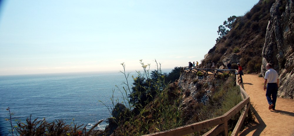
The following morning we left for the Burbank airport to pick up the rental car for the drive North. I left my car in the airport long-term lot, and we all switched over. I don't remember what kind of car we ended up with. I was hoping for another G6 of some kind, since they were roomy and had a nice sound system and decent gas mileage, but we didn't get anything nearly that nice. It was a typical economy car, a Chevy something or other. After leaving the airport, we aimed in the direction of Santa Barbara and Big Sur and started driving. When we arrived in Santa Barbara, we stopped for a bit to check out the pier and walk around town. Since we weren't very hungry yet, we continued further up the coast before we grabbed lunch. The land between Santa Barbara and Big Sur is dotted with scenic vistas, live oaks and mountainous outcroppings. One of the outcroppings that we passed had some people on the summit:

Here's a shot of another cool outcropping shrouded in marine mist:

My mom had a guidebook which said that the town of Pismo Beach had a nice waterfront area and a good restaurant for burgers etc, so we ended up stopping there for a look around. The line for the restaurant was impressively long, but we hung in there and scouted out the town a bit. It was a really quaint area, and I think that everyone enjoyed the brief time we spent there. Just North of Pismo Beach we spotted a mansion on a hill top that my Mom knew some back-story to. Something about an uber-rich guy who put all of his money into repeatedly expanding this mansion. I guess that he must have had nothing better to spend the money on, since it seems pointless to me to continue expanding a house beyond what you could possibly require for your own shelter. Anyway, here's a shot of this dickhead's dwelling:

As we continued to head up the coast, the visibility continued to diminish. The big concern with travelling through Big Sur in the Summer is the great potential of a thick marine fog that obscures all the scenic beauty. It definitely appeared that we were going to have this problem today... Before we got into the mountaineous region, we stopped at the beach with all of the Elephant Seals. This is the quintessential roadside attraction and due to the absurdly large nature of these sea beasts, is sure to please. When we arrived there was a pair of large ones sparring in the water:

Also, we saw one of the larger (and uglier) ones return from a swim:

There was also a little baby seal putting sand on its back to keep cool:

Here's a shot of Katie, Dad and I at the elephant seal beach. This may be the last shot ever taken of my Wrens shirt without the horrendous stain on it:

Once past the Elephant Seal Beach, the road quickly begins to meander up a mountain:

As you can see, the sky was quite overcast. However, unlike previous times that I had been through Big Sur, the road wasn't completely enclosed by the marine layer, and you could at least look out to sea. We stopped off at several good lookouts, including this one at Guano Rock:

When looking up the mountains behind us, we could just catch a glimpse of the sky peeking through up above:

At the next lookout we were able to capture a shot of the road as it traverses a bridge and then rounds a corner along the coast:

As we made our way through the mysterious landscape of Big Sur, the marine layer continued to rise, and surprisingly, we had good visibility for the majority of the ride. We had a bit of trouble within the family of communicating when we'd like to stop for views, pictures, etc, but overall we spent about the right amount of time site-seeing. Julia Pfieffer-Burns State Park was a big hit, as usual, for the nice cove and small waterfall. Much of the area surrounding the park was still charred from the big forest fire a few weeks before:

Within the park, we did the standard walk down to the waterfront and the overlook of the cove. Here's a picture of my dad on the walkway:
My mom did a terrific job of capturing the cove from a vantage point on the overlook. Notice how the picture is framed by a palm on the left and a pine on the right, and don't miss the small waterfall in the center. Very Nice! By the way, the reddish stuff out in the ocean beyond the cove is a kelp forest.

Here's a zoomed in shot of the waterfall:

This next shot, which is up the coast from the end of the walkway in Julia-Pfeiffer Burns State Park, is perhaps my favorite shot from the entire trip:

After leaving the park, we continued up the coast and entered Big Sur proper. The mountains in this part of the coastal journey are the largest by far. Here's a shot of one of them looming over the road:

After passing through Big Sur we reached that spot with the weird prison-like compound atop a mountain in the water. Here's a shot of it, what do you think it is?

The sky was becoming overcast once again, indicating to us that we passed through Big Sur at exactly the right time. Considering how often the coast is completely shrouded in mist, we were very lucky to be able to see as much as we did! The remainder of the trip was rather uneventful. On our way to Pleasanton we stopped in San Jose to see Matt and grab dinner with the folks who he was staying with. By the time we arrived at the Marriott, we were all pretty exhausted.
The following day, a Tuesday, we went into the City of San Francisco to check out the waterfront and Matt came with us. Here's a shot of the residential hill nearby (I don't know the name of each of the districts):

And here's a picture of the mouth of the bay with the Golden Gate Bridge in the background:

And here's a rare shot of the Parker siblings in the same place at once!

And of course, a shot of Alcatraz, sitting solemnly in the center of the bay:

After becoming fed up with the windiness of the piers, we jumped back in the car and drove around the city. The number of one-way streets, coupled with my complete lack of knowledge of where we were going, made for a fun cruise. At some point, we passed by the city hall:

We decided to take a drive around the Golden Gate Park area, where I would be seeing Radiohead in a few months. Here's one of the main buildings inside the park:

Matt had enough free time to visit Yosemite with us the following day, so he joined us back at the hotel for the evening. As soon as we got back in, we hopped on our computers for a healthy dose of escapism. If I remember right, I spent my evening fretting an Aphex Twin for Frets on Fire:

As soon as the next day dawned, we all packed into the car and left for Yosemite. The ride there involved some driving along rather precarious enscarpments, causing my Mom to feel a bit not-so-well. Fortunately, this didn't last long. We knew that there were forest fires near the park, but he hoped that the smoke from them wouldn't affect the views in the valley too much. Fortunately this was the case, although the smell in the air indicated that the fire was not far off. Here's a shot of the first waterfall we spotted after passing through the tunnel into the valley:

The first place that we stopped involved a short hike up to one of the 'smaller' waterfalls on the South side of the valley. The hike was basically a boulder scramble up to the base of the waterfall:

As we travelled further up the valley, we caught a glimpse of Yosemite falls, which was really only a trickle this late in the Summer:


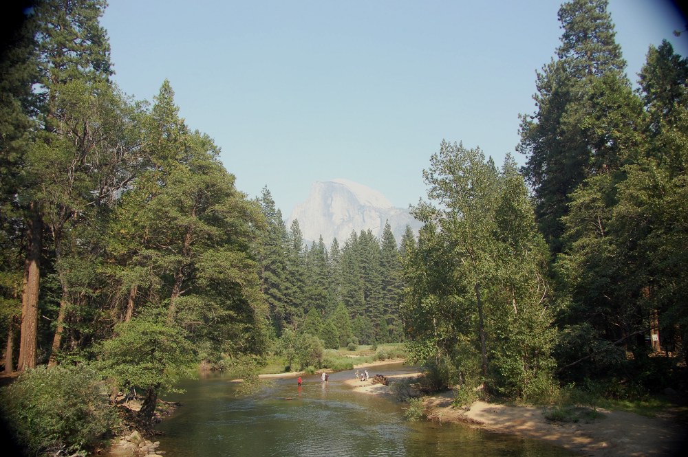
Beyond this, near the end of the loop, was the bridge where you can get a good shot of Half Dome:
Before leaving the parking lot near the bridge, we met a nice young mule dear that appeared to be scrounging for handouts:

And, of course, no trip to Yosemite would be complete without pictures of El Capitan.


On the way out of the park, it appears that the wind changed somewhat because we drove through areas that were covered with smoke from the fires:


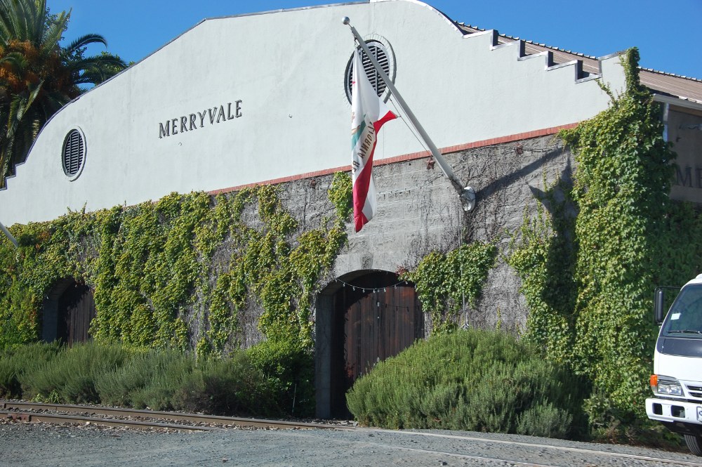
After another full day, we were glad to get some rest that afternoon. The following day Matt returned to San Jose and Mom, Dad, Katie and I went to Napa Valley for some Wine Tasting. Of course this was considered one of our 'off days,' but we had fun nonetheless! The first winery that we stopped at was Merryvale, which was the place where Rafaela and I had so much fun previously.
One thing that Raf and I never noticed was the cask room, which I thought was super cool:

Here's the whole family (minus Matt) in the tasting room of Merryvale:

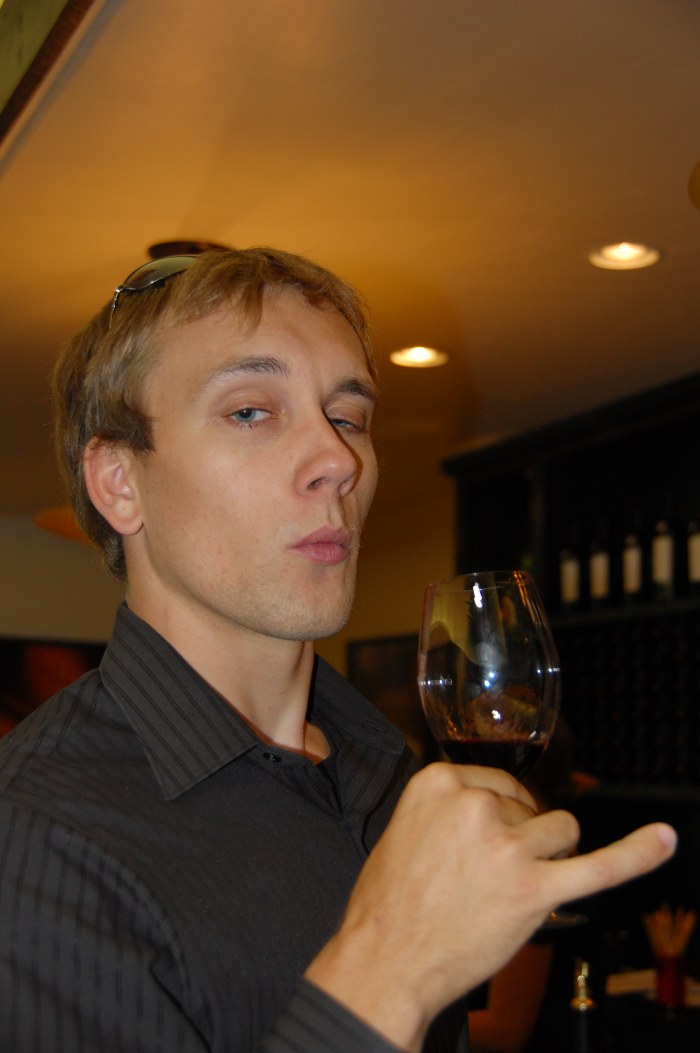
I tried very hard to stay in character throughout the wine-tasting experience:
After Merryvale, we grabbed some food in the town at a place called Taylor's Automatic Refresher, where the folks seemed really nice:

Once we had eaten our fill, we stopped at Robert Mondavi to taste some of their grapes, but not their wine:

Although the folks at Merryvale were friendly as usual, the wine was not incredibly good, according to my parents. On our way out of the valley, my folks spotted the Folie a Deux winery, which I guess is pretty good. So we stopped in their tasting room and I must say that their wines were really incredible, if a bit expensive. The quality certainly cheered up my parents a bit, and my mom even wanted to buy a bottle. Fortunately I talked her out of it (at $100 per, it seemed a bit much). Regardless, this last stopover seemed to make the Napa trip as far as the wine was concerned.
The next day was our last in Northern California.and we mostly relaxed and got ready for the drive South through Sequoia. When the time for departure arrived, we had properly stocked up on victuals and refreshments. This was going to be the first time that I entered the Sequoia park through the North entrance. We were also planning on stopping in the Grant Grove area, which is a spot I don't believe I'd been to yet. One of the cooler things in the grove was an old cabin that had been built in the late 1800's. The cabin was built so sturdily that it seems like it will never break down:

The largest tree in the area, and the third largest tree in the world overall, was the General Grant tree, which my Mom took a nice shot of here:

After the Grant Grove, we stopped by the Sherman Tree. To save time, I dropped my parents off at the trailhead and drove to the foot of the trail, this way they wouldn't have to hike back uphill and could just hop in the car after seeing the tree. Here's the best capture of the tree that my Mom took:

After General Sherman, we drove up past the visitor center to a spot I hadn't been to before. I was surprised to find that there was actually a trail on top of Moro Rock. One of the things that I always felt was unfortunate about Sequoia was that it's beauty required hiking to see, because there were no good vantage points of the high sierras. Today I found out that I was wrong. The trail to the top of Moro gives visitors an incredible view of the Great Western Divide, just about as good as the view from Panther Gap. Here's what the trail up Moro looked like:

Here's a shot of Castle Rocks, across the valley from Moro:

And here's the view of the Great Western Divide:

After hiking Moro rock, we continued down the road behind the visitor center. To our delight, there was a group of Sequoias named after us!

Here's a better shot of the trees themselves:

Further up the road is the famous Tunnel Log that you can drive your car through:

I wonder if they widened this tunnel for the age of the SUV? The end of the road is a spot called Crescent Meadow. The number of cars that were parked here indicates to me that there must be a number of overnight backpacking trails that start here. Anyway, here's a shot of the meadow itself:

As always, the drive down from the park, in the foothills of the Sierras, was absolutely beautiful, even in Summer. Here's a few shots near the town of Lemon Cove:


After leaving Sequoia we continued back to Pasadena, on the way stopping for some Qdoba in Bakersfield. The last couple of days we spent relaxing and spending time around town. Overall, I think the trip went fantastically well. It's incredible that we were able to pack in so many sight-seeing destinations without the stress levels getting too high.
Forward to Fall 2008
Back to Index